|
May, 2009
By John Evanoff
My ninth favorite on my top ten-list of Treks around Reno and the
Truckee Meadows, takes a little getting used to because it is dry
and relatively tough. Because I spent a few decades living on the
side or near Peavine Mountain, I developed a sense of oneness with
its many canyons, trails and roads. When I was young in the early
1950’s, it was my nearby hunting ground for quail, chucker,
sage hen, dove, rabbit and deer. I also spent time exploring the
old foundations of the mining ghost towns on it slopes. A couple
of mining sites in particular were not exceptionally well preserved.
They were Poeville (once called Peavine) and Keystone. Poeville
had 500 people for a time and Keystone only had 200 people living
in it at its height in late 1863. Both had bars, small hotels, livery
stables, dry goods stores, one big shop in Poeville and one small
shop for repair of freight and mining wagons and Chinese laundries.
For less than a decade in Keystone and a decade and a half for Poeville,
the townsfolk of these two tiny mining towns worked several areas
around the south and east side of the mountain and opened four fairly
large mines looking for gold and silver. What they found was mostly
copper and quartz bearing rock, the quartz being what they were
hoping would hold the gold flakes they had found throughout the
region. One mine, the Golden Fleece, was especially interesting
in the amount of shares sold because of the initial abundance of
gold bearing quartz ore. The fairly rich find led to more shares
being sold. The thought was they would find even larger gold veins
embedded in the quartz deeper into the mountain. The quartz veins
played out and so did the enthusiasm and money, so the miners up
and left for other strikes in Nevada, notably Virginia City, Tonopah
and Austin.
When it comes to exploring and providing a way
to stay in shape and enjoy Reno and its surroundings, Keystone Canyon
and Peavine Mountain is a definitive yes on my list of all time
favorites. This place didn’t always look like this though.
I remember when there were only a few small jeep roads from the
edge of town at what is now the corner of Seventh Street and Keystone.
McCarran was not there, nor were most of the homes northwest of
University Terrace. The only homes and farms were oddities on the
slopes of the mountain in and around what are now Elmcrest Drive
and Kings Row. One pig ranch was in the current canyon where Elmcrest
goes up the hill and two homes were on the slopes where Kings Row
is now located and where a dirt airfield was located once. On the
Raleigh Heights side of the mountain where Poeville resided, the
only road was a dirt one leading west up a canyon from where the
Bonanza Casino now sits. Virginia Street was Highway 395 North and
was only two narrow lanes.
Nowadays, you can go straight up Keystone Avenue
right to the Keystone Canyon trail or from North Virginia Street
past the University of Nevada campus to a left on N. McCarran Boulevard
and then right on Keystone to just northwest of the large water
tank. The trail is relatively easy for about a mile and a half past
the backside of the hill where the Nevada “N” can be
viewed and then rises up from a slight jeep trail to a single dry
creek trail. The creek trail rises to meet the jeep road above Hoge
Road well west of North Virginia Street around Parr Boulevard. If
you do not have the time to take the entire route from the base
of Keystone Canyon, this spot might be a way of cutting your time
by an hour. From the top of Hoge Road there is a menagerie of mountain
bike and hiking trails and you can pick any one you wish, but the
best is the steepest straight west up to the top where it intersects
the Peavine Road (a road itself used by many mountain bikers) and
climbs to the very top of Peavine. The rise is swift up some rocky
stream beds along jagged granite and quartz canyon walls and old
lava outcrops.
There are some neat saddles in-between the canyons
and each ascending hill, a couple of small springs and of course,
lots of wildlife along the way. The trek is relatively relaxing
if you take the time to look around and gather in the sights. Some
of the trails seem to branch off here and there, so if you seem
to be heading downhill, you’re going the wrong way. Keep heading
up hill until you reach the Peavine Road. Once you’re on the
Peavine Road, it’s an easy romp up to the top of the mountain.
Watch for traffic going both ways, especially if you’re on
a bike. There are three trails quite easy to discern that are not
part of the heavily driven Peavine Road and I liked to use any of
them instead of the road simply because it was more direct and free
of dust. A good topo map of the mountain will show them up quite
nicely and you can mark each one as a challenge to archive your
climbs and mount for display one day.
This trek will get to you quickly if you are not
in shape. My best advice is to make sure you can put on the miles
up hills before you attempt it, but be forewarned; it’s well
worth the effort. Once you are on top of Peavine, about 3,500 feet
from where you started, you can plant yourself for a short picnic
or find a spot in the aspen grove below the radio towers at the
top to bed over for the night. There are two peaks on Peavine just
a few hundred yards apart, both a bit over 8,200 feet and they both
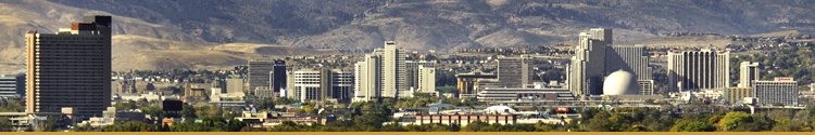
make great spots to look over the entire Truckee Meadows and the
North Valleys. The journey down is much easier, but tougher on the
shins. I advise you to take the road down the side of the mountain
till it reaches the intersection facing Hunter Lake (Las Brisas
Road on Google Earth) and then head straight down to Roxbury Drive
north of Las Brisas which comes off of North McCarran in the Robb
Drive area of northwest Reno. This is the spot where the town of
Keystone got its name. A large rock face sticking out of the ground
above the old Seventh Street Pits is all that is left. The two large
mining shafts have been filled and covered at Poeville and Keystone,
but several mining shafts remain across the mountainside. It is
a good measure of safety you should stay well away from the edges
of these shafts so as not to fall into them.
Try to get to the departure trail sites early in
the morning so the ascent is cooler. The southern flank of Peavine
is mountainous and you must be prepared with good hiking boots and
appropriate clothing. Mountain Bikers must be ready to take on extremely
tight turns and rocky dry creek trails. Depending on your level
of ability, take as much water as you can for the journey because
there is none anywhere on the route. Fruit and snack bars are light
and full of nutrition and energy. Please take a camera. You will
definitely take lots of pictures.
This walk is approximately five to seven miles
in length uphill depending on where you start. The trek to the top
and down to Seventh Street is a full day and an additional five
miles. Take your cell phone and have someone pick you up to drive
you back to the canyon parking lot. In my day though, we just walked
along the hillside past the “R” on the hillside all
the way back to the base of the canyon at the University of Nevada
Campus where we used to start.
By the way, if you just want to walk the Keystone
Canyon Trail, it’s only a couple of hours round trip and enjoyable
as a quick morning or evening trek. Either trail is gratifying.
If you become infatuated with Peavine from one or more of these
walks on the mountain, you can join a group of folks in town who
feel the same way. The Friends of Peavine is a group dedicated to
saving the mountain from overuse and destruction. I hope you discover
my ninth favorite on my list of all time favorite treks of Reno
because I think you will be pleasantly rewarded with the gain in
elevation and your spirit.
|